Last night was the first time in almost two weeks that we weren’t camped by train tracks or a major road. Damn was it quiet! The noise doesn’t keep us awake, but waking up in the middle of the night sure sounded different. Because it didn’t sound like anything. It’s the little things.
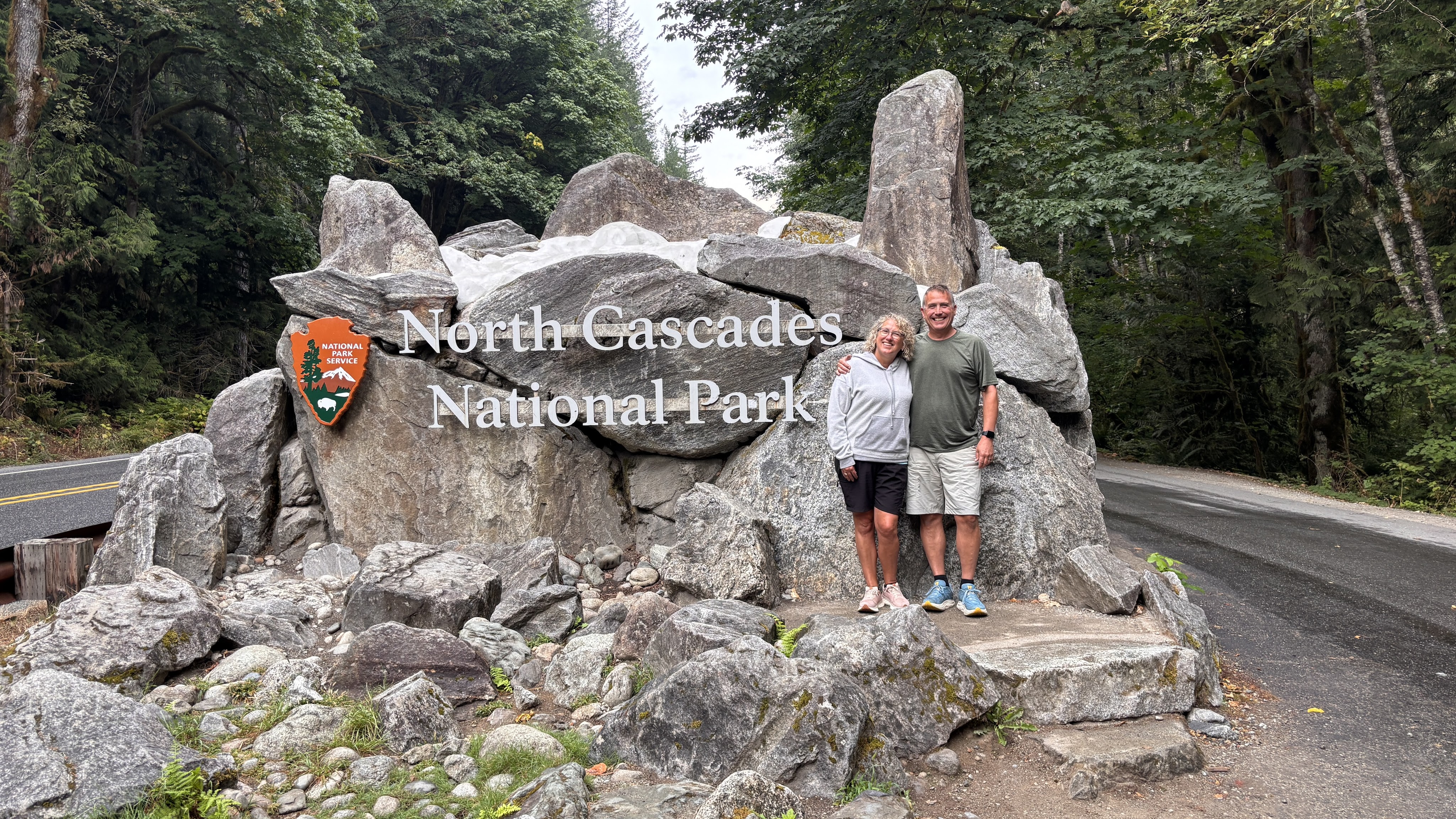
Today was kind of a bonus day here in North Cascades. We were supposed to have been driving in from Canada before we (very wisely) rerouted our trip to put us here a day early. So what better way to spend the day than heading into North Cascades National Park! This park marks our 28th national park since our RV journey began in late 2023. If my math is correct, we are now 44.4% of the way to our goal.
If you haven’t seen it, you can see a map here with all the National Parks we’ve visited. We’ve driven through lots more National Forests and Recreation Areas, but I don’t mark them unless we actually get out of Livvy and do something there!
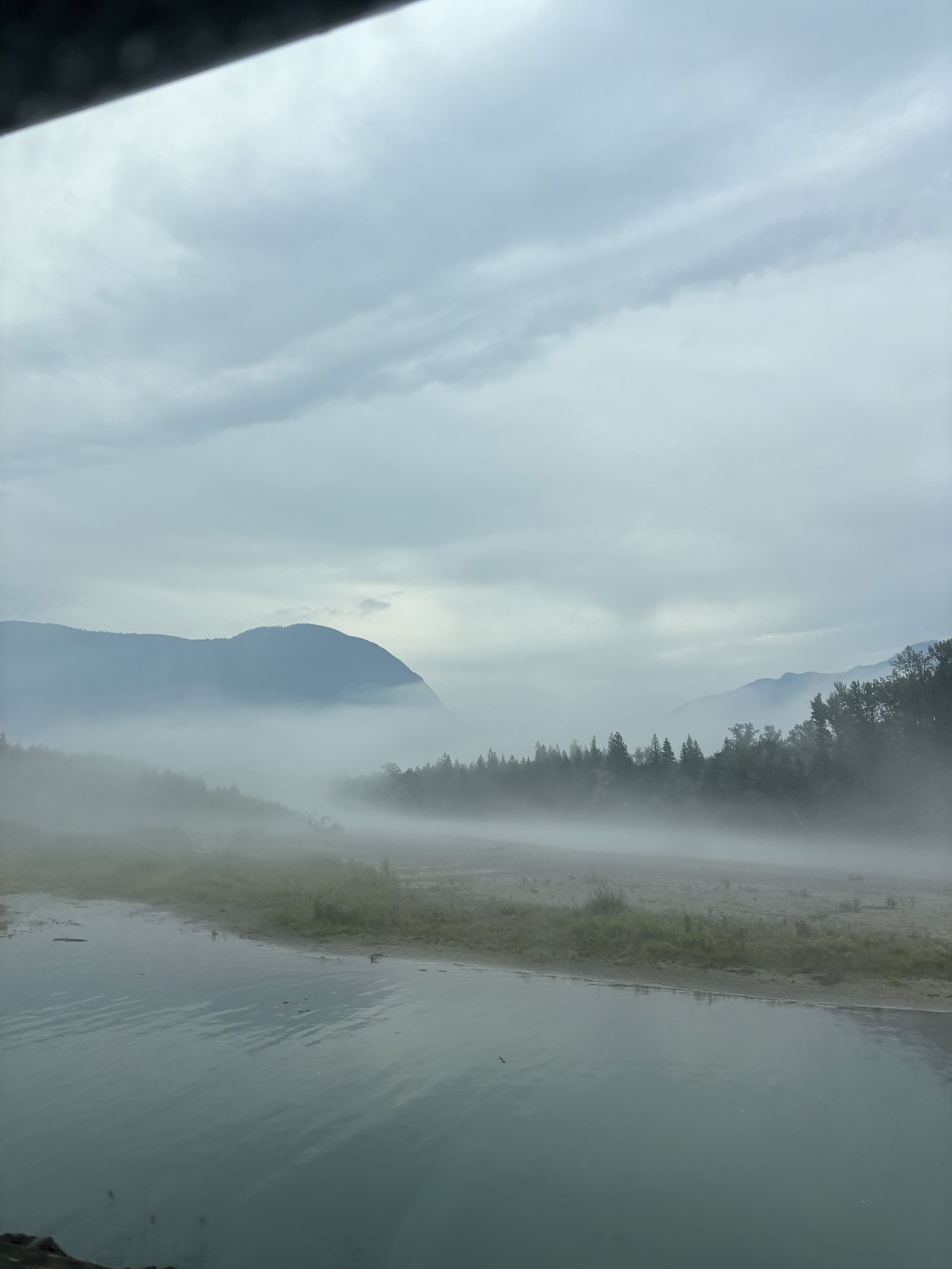
The day started overcast and foggy. The fog cleared during the day, but the clouds stayed for the duration. The combination gave an eerie look to the Skagit River we followed nearly all day. Our drive to the visitor’s center took about 50 minutes, but the coffee was hot and the road was empty.
Now, we learned some interesting facts about North Cascades last night and today. First, the park is broken into two units, North and South. The dividing line follows the Skagit River, which runs mostly East-West in this area. Surrounding the river on both sides, sandwiched between the North Cascades units, is the Ross Lake National Recreation Area. It’s the meat between the Unit-Buns. This corridor also contains the main road near the park, Route 20.
What’s really amazing is that the official national park sign, the visitor’s center, and most of what everybody visits, falls within the National Recreation Area – not in the National Park itself. North Cascades is not heavily visited, despite its proximity to Seattle, seeing only 900,000 visitors per year. The funny part is that only 20,000 – 40,000 of those visitors ever set foot within the actual National Park boundary! This is due to both the extreme nature of the park lands as well as lack of easily passable roadways within. The most visitors get is glimpses of the nearby peaks that frame the boundary.
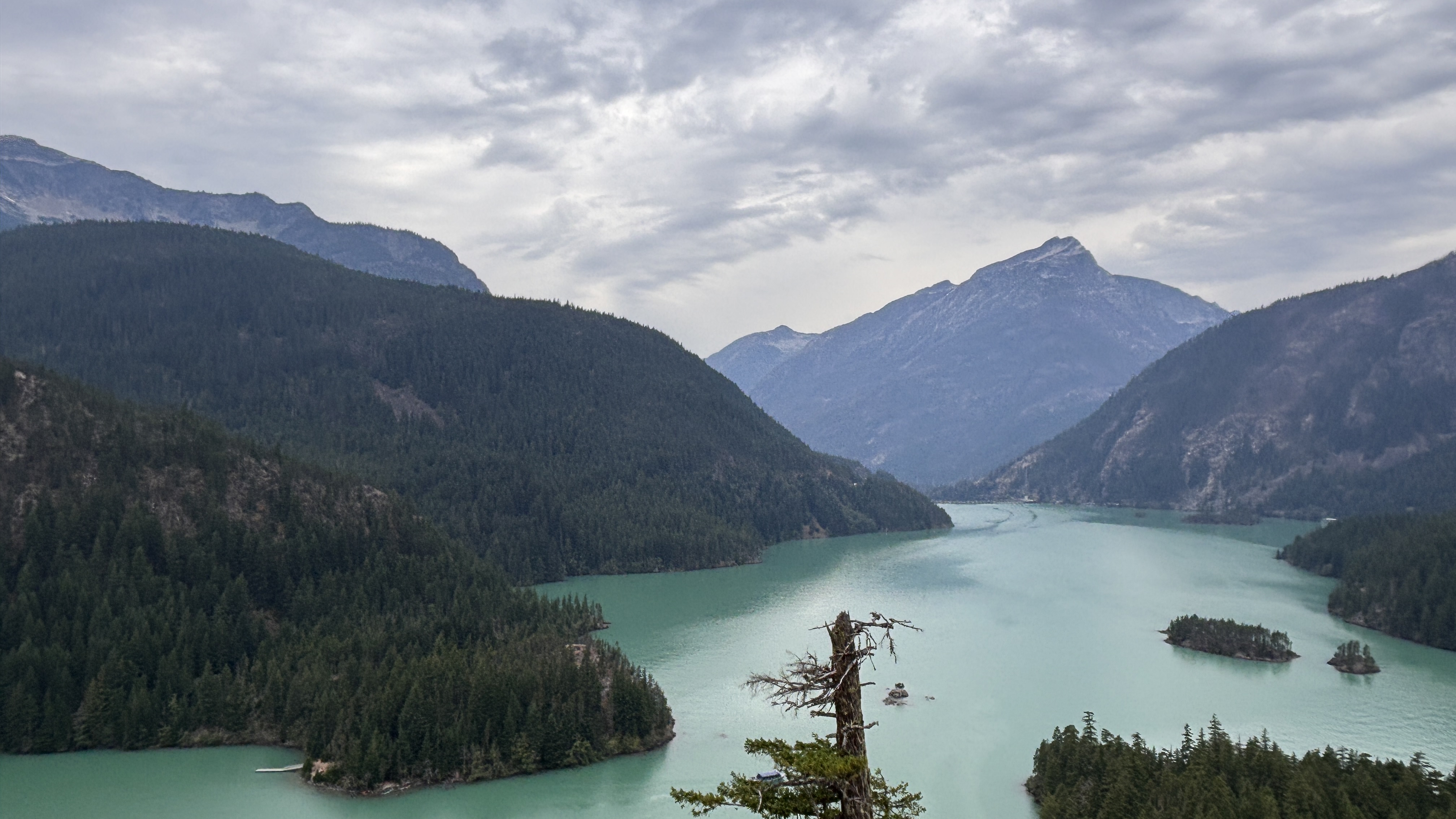
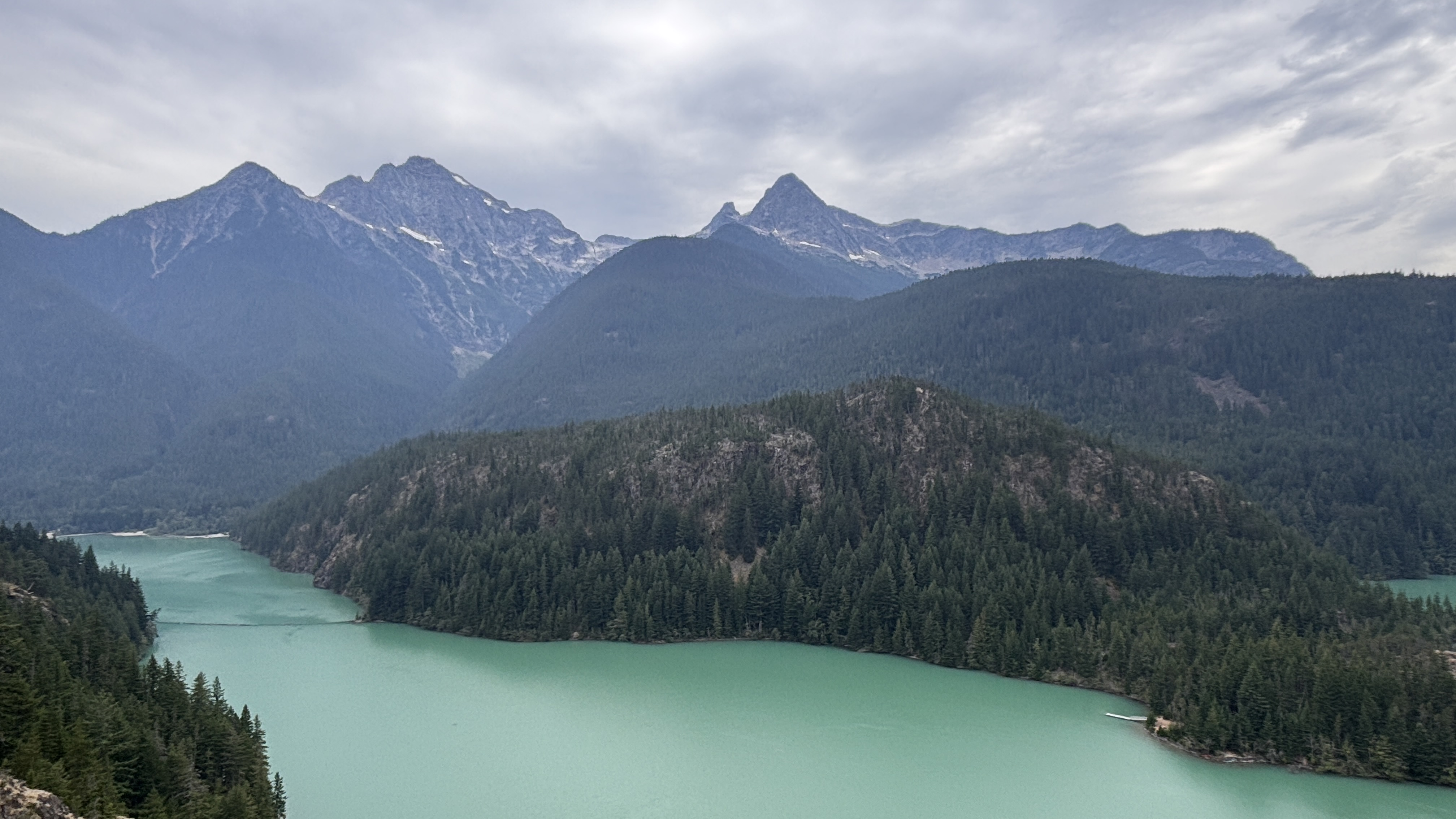
That said, we certainly did not feel short-changed. The area is quite stunning, regardless of boundary. The Skagit River is dammed in three places within the park, with each dam holding back progressively bigger lakes. The lakes and river carry the same unworldly aquamarine hue that we saw at Lake Louise.
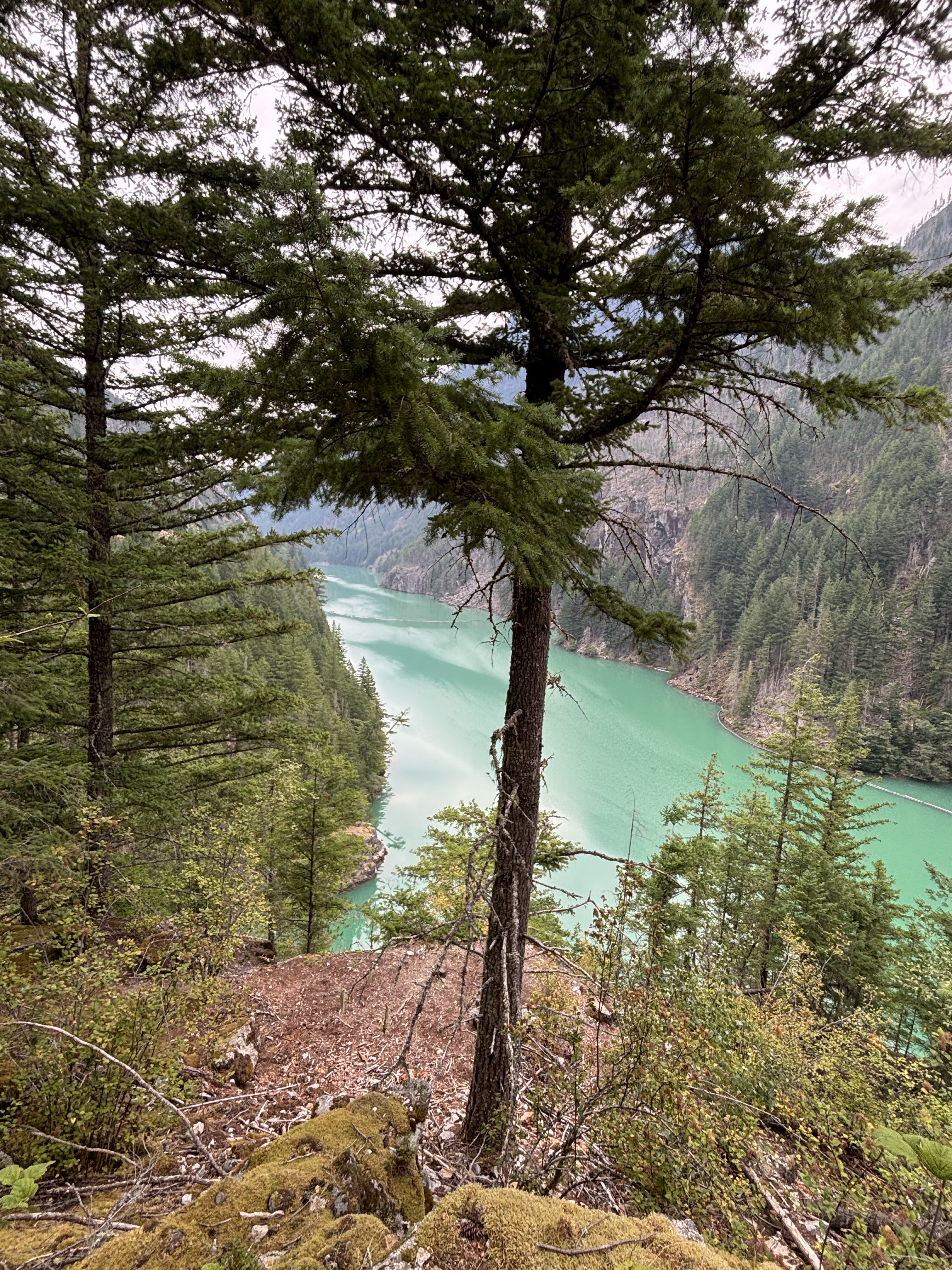
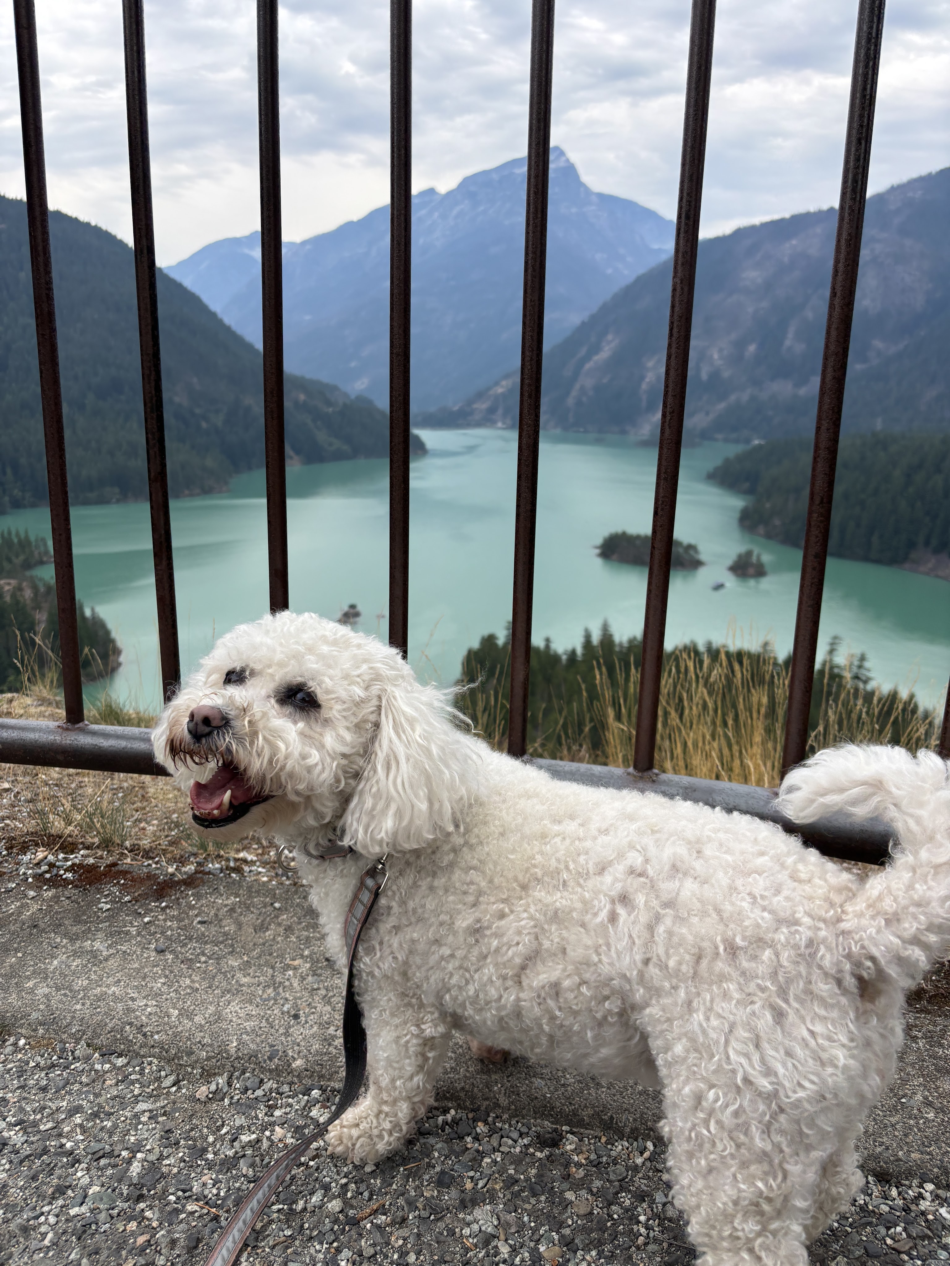
We stopped at Diablo Point, probably the most recognizable spot along the park road. The lookout provides an elevated view of Diablo Lake, and panoramic views of the surrounding peaks. It was spectacular! Everything we hoped it might be. Even in the flat light the lake was almost iridescent.
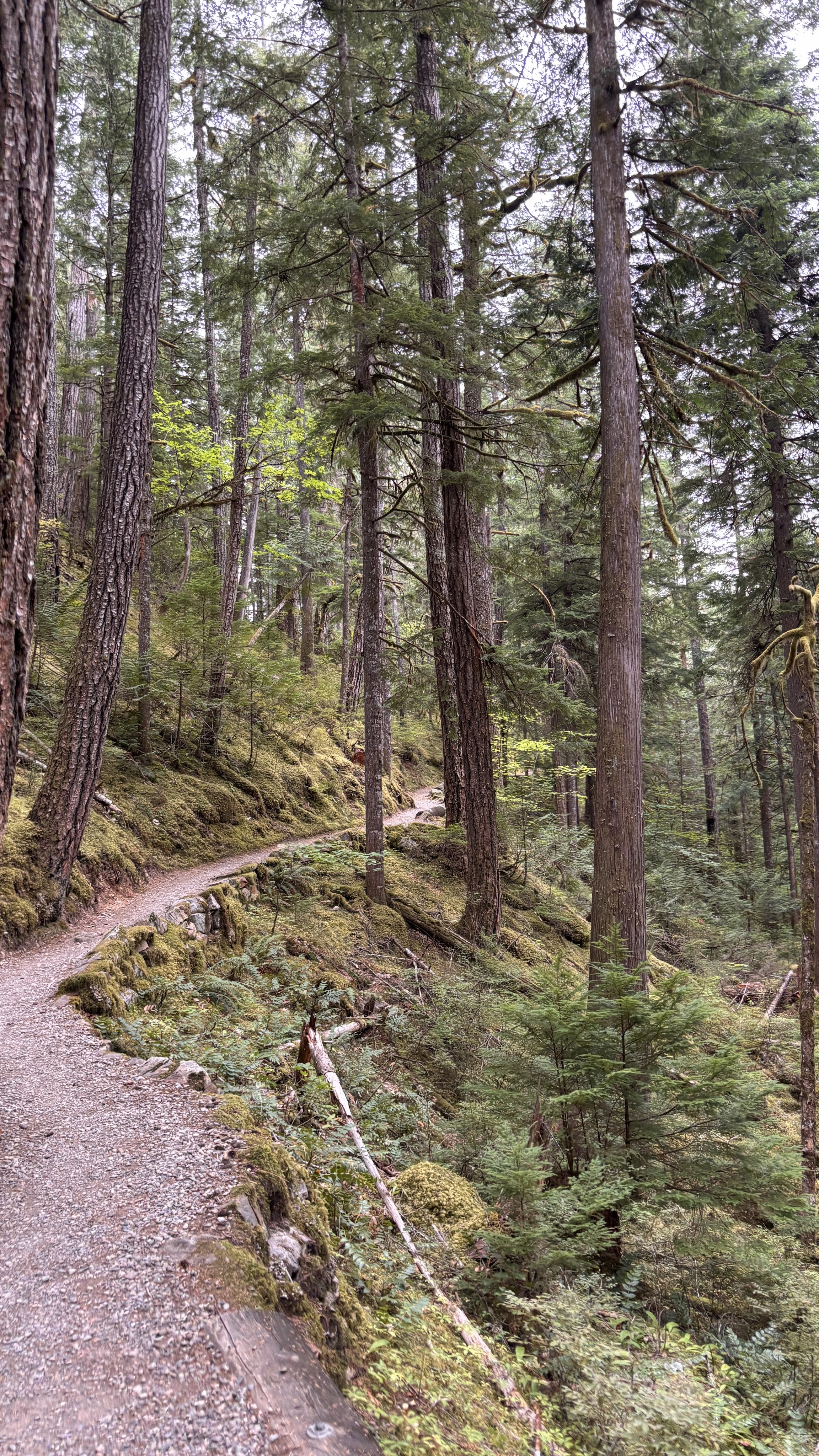
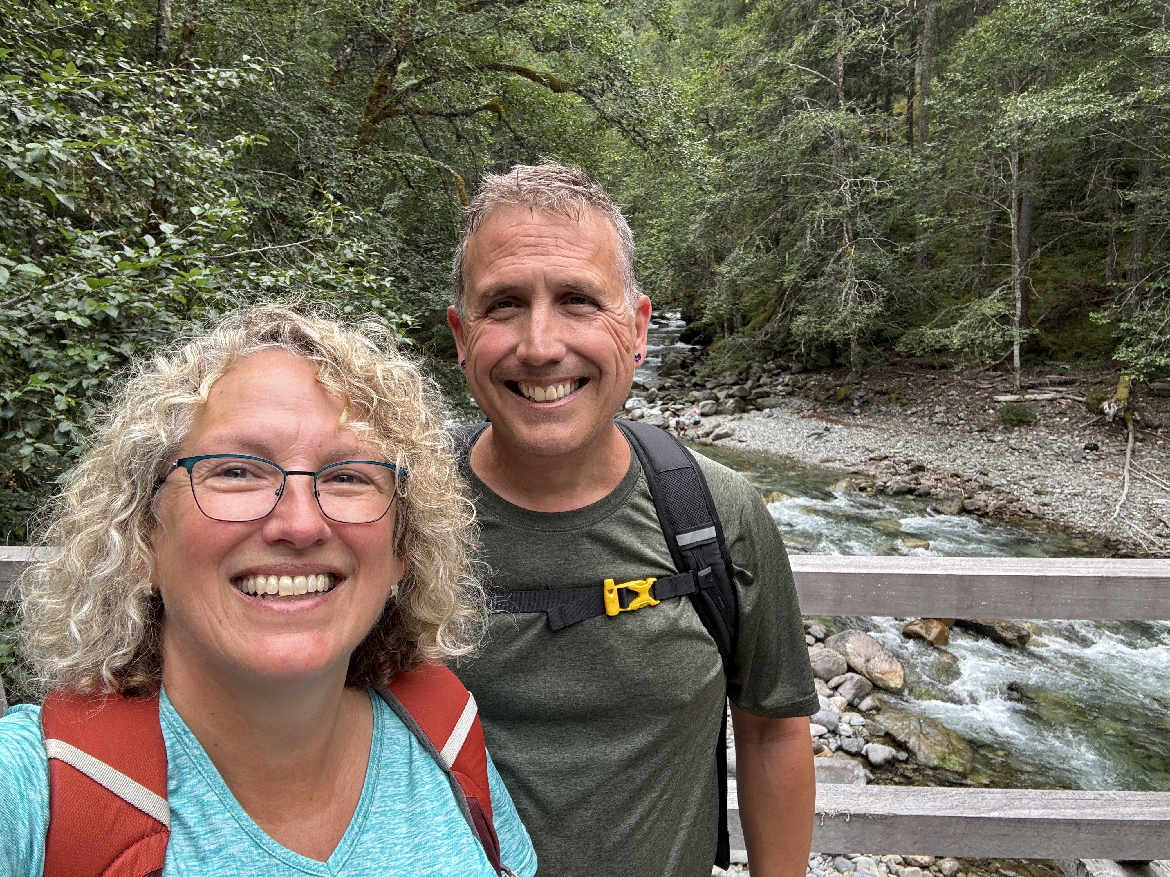
Continuing past Diablo, we pulled off at what was to be our turnaround point, which was also a trailhead for several hikes. It was noon, but the temps were low enough we could leave Daisy in the RV for a while. So we strapped on our hiking boots, loaded our pack, and set off on a hike.
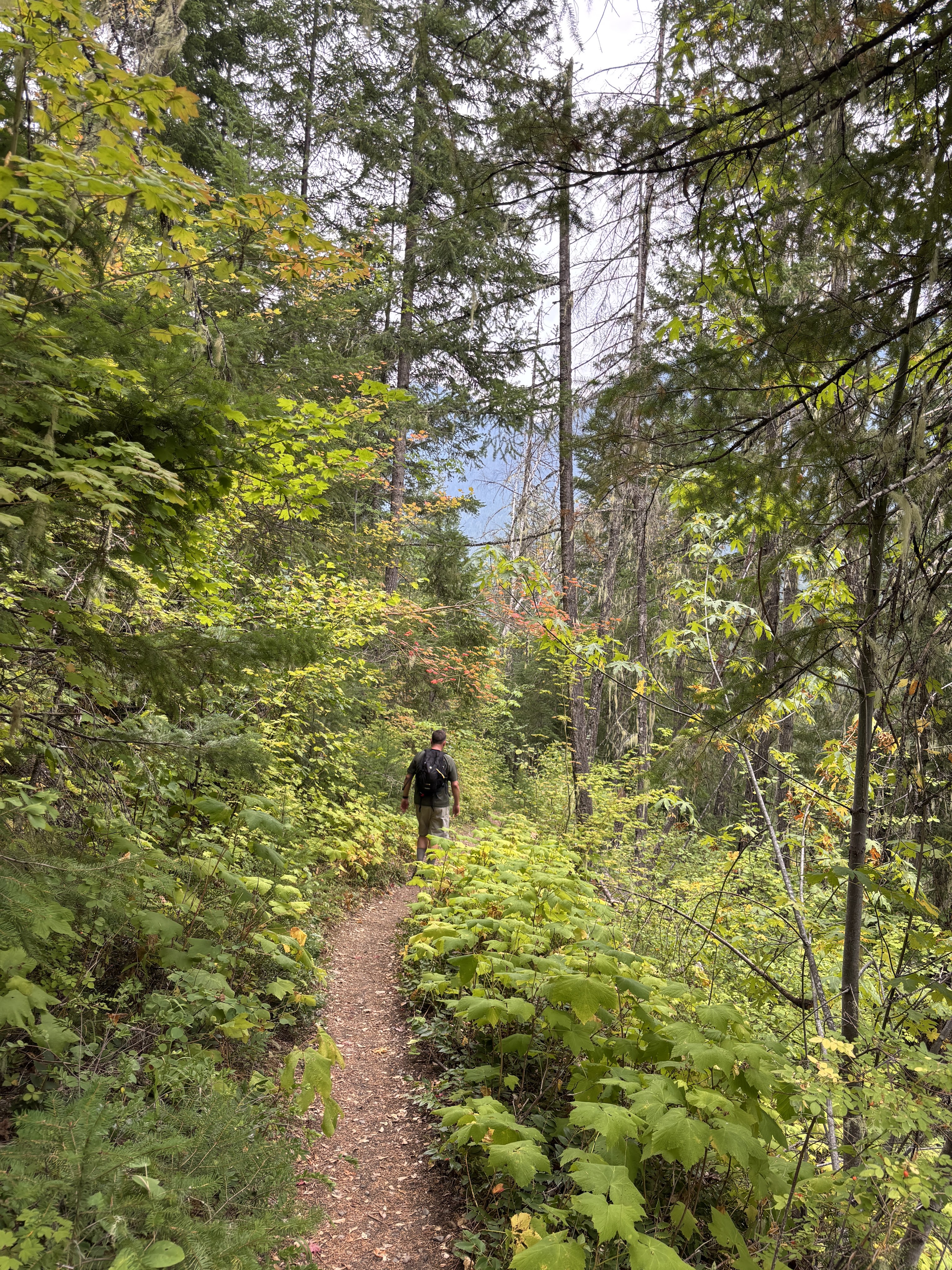
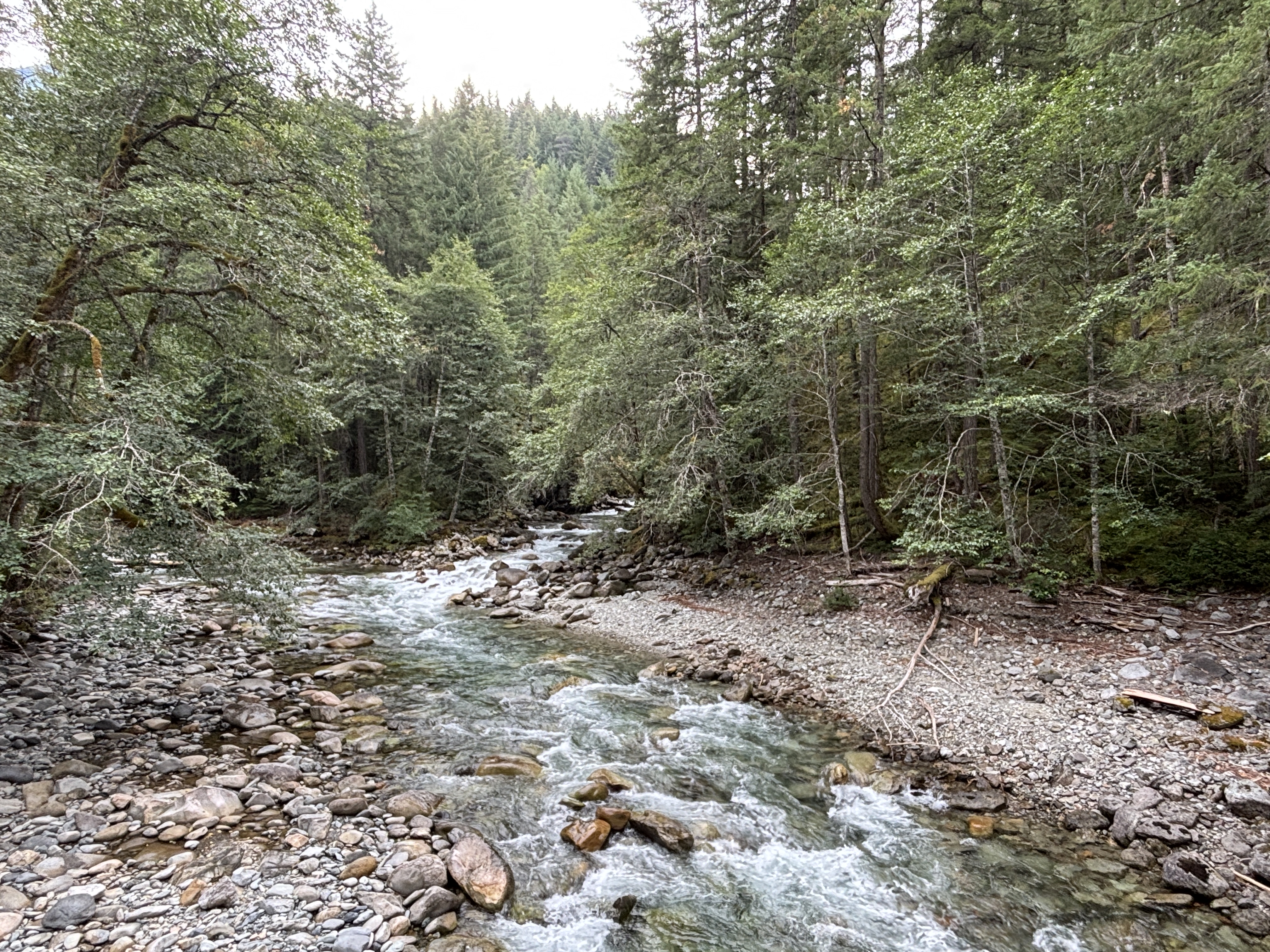
The trail followed along Ruby Creek, which tumbles down into Ruby Lake which was formed by Ruby Dam (imaginative naming system, huh?). The out-and-back trail was 7.2 miles long and included nearly 1,000 feet of elevation gain. A real thigh-burner, but so worth it. And to make it even better, we saw only 5 people on the ENTIRE trail. Green surrounded us. Even the forest floor was completely covered in moss for huge portions of the trail. And a calmness and quiet we had been longing for. Truly perfect.
We returned to camp, took well-deserved (and NEEDED) showers, and ate dinner. The clouds hanging in the sky all day are still there, but it’s still dry. We are hoping for some clearing tomorrow because we’d like to drive the park road again and perhaps tag another hike. But from what we saw today, this place certainly lives up to the rugged beauty we anticipated.
Leave a Reply